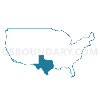
Alamo Area COG (Northwest) & Blanco County PUMA, Texas
About
Outline
+%26+Blanco+County+PUMA%2c+Texas_A280.png)
Summary
| Unique Area Identifier | 194189 |
| Name | Alamo Area COG (Northwest) & Blanco County PUMA |
| State | Texas |
| Area (square miles) | 3,545.41 |
| Land Area (square miles) | 3,533.24 |
| Water Area (square miles) | 12.18 |
| % of Land Area | 99.66 |
| % of Water Area | 0.34 |
| Latitude of the Internal Point | 30.15789100 |
| Longtitude of the Internal Point | -98.91947600 |
Maps
Graphs
Select a template below for downloading or customizing gragh for Alamo Area COG (Northwest) & Blanco County PUMA, Texas
+%26+Blanco+County+PUMA%2c+Texas_T0.png)
+%26+Blanco+County+PUMA%2c+Texas_T1.png)
+%26+Blanco+County+PUMA%2c+Texas_T2.png)
+%26+Blanco+County+PUMA%2c+Texas_T3.png)
+%26+Blanco+County+PUMA%2c+Texas_T4.png)
+%26+Blanco+County+PUMA%2c+Texas_T5.png)
+%26+Blanco+County+PUMA%2c+Texas_T6.png)
+%26+Blanco+County+PUMA%2c+Texas_T7.png)
Neighbors
Neighoring Public Use Microdata Area (by Name) Neighboring Public Use Microdata Area on the Map
- Alamo Area COG (Northeast)--Comal County PUMA, TX
- Alamo Area COG (Southwest) PUMA, TX
- Bexar County (Northwest)--San Antonio (Far Northwest) & Helotes Cities PUMA, TX
- Capital Area COG (Southwest)--Hays County PUMA, TX
- Central Texas COG (West), Burnet & Llano Counties PUMA, TX
- Concho Valley COG & Permian Basin Regional Planning Commission (East) PUMA, TX
- Middle Rio Grande Development Council PUMA, TX
- Travis County (West, South & Outside Austin City) PUMA, TX
Top 10 Neighboring County (by Population) Neighboring County on the Map
- Bexar County, TX (1,714,773)
- Travis County, TX (1,024,266)
- Hays County, TX (157,107)
- Comal County, TX (108,472)
- Kerr County, TX (49,625)
- Burnet County, TX (42,750)
- Kendall County, TX (33,410)
- Gillespie County, TX (24,837)
- Bandera County, TX (20,485)
- Llano County, TX (19,301)
Top 10 Neighboring County Subdivision (by Population) Neighboring County Subdivision on the Map
- San Antonio North CCD, Bexar County, TX (309,717)
- San Antonio Northwest CCD, Bexar County, TX (269,553)
- Southwest Travis CCD, Travis County, TX (53,442)
- Canyon Lake CCD, Comal County, TX (44,736)
- Dripping Springs-Wimberley CCD, Hays County, TX (35,612)
- Kerrville CCD, Kerr County, TX (33,667)
- Boerne CCD, Kendall County, TX (27,018)
- Marble Falls CCD, Burnet County, TX (22,376)
- Bandera CCD, Bandera County, TX (17,759)
- Fredericksburg CCD, Gillespie County, TX (16,947)
Top 10 Neighboring Place (by Population) Neighboring Place on the Map
- Kerrville city, TX (22,347)
- Fredericksburg city, TX (10,530)
- Boerne city, TX (10,471)
- Fair Oaks Ranch city, TX (5,986)
- Scenic Oaks CDP, TX (4,957)
- Comfort CDP, TX (2,363)
- Ingram city, TX (1,804)
- Blanco city, TX (1,739)
- Johnson City city, TX (1,656)
- Harper CDP, TX (1,192)
Top 10 Neighboring Unified School District (by Population) Neighboring Unified School District on the Map
- Comal Independent School District, TX (99,194)
- Boerne Independent School District, TX (34,875)
- Kerrville Independent School District, TX (33,259)
- Marble Falls Independent School District, TX (23,431)
- Dripping Springs Independent School District, TX (22,928)
- Fredericksburg Independent School District, TX (21,951)
- Bandera Independent School District, TX (17,313)
- Llano Independent School District, TX (16,958)
- Ingram Independent School District, TX (8,319)
- Comfort Independent School District, TX (7,624)
Top 10 Neighboring State Legislative District Lower Chamber (by Population) Neighboring State Legislative District Lower Chamber on the Map
- State House District 122, TX (246,846)
- State House District 45, TX (205,670)
- State House District 47, TX (198,311)
- State House District 54, TX (196,447)
- State House District 73, TX (187,204)
- State House District 53, TX (145,845)
- State House District 74, TX (143,566)
Top 10 Neighboring State Legislative District Upper Chamber (by Population) Neighboring State Legislative District Upper Chamber on the Map
- State Senate District 25, TX (984,664)
- State Senate District 14, TX (872,176)
- State Senate District 24, TX (778,148)
- State Senate District 19, TX (766,044)
Top 10 Neighboring 111th Congressional District (by Population) Neighboring 111th Congressional District on the Map
- Congressional District 21, TX (856,954)
- Congressional District 23, TX (847,651)
- Congressional District 25, TX (814,381)
- Congressional District 11, TX (710,682)
Top 10 Neighboring Census Tract (by Population) Neighboring Census Tract on the Map
- Census Tract 9603.02, Kerr County, TX (7,942)
- Census Tract 9606, Kerr County, TX (7,512)
- Census Tract 9503, Gillespie County, TX (7,104)
- Census Tract 1821.02, Bexar County, TX (6,641)
- Census Tract 1821.01, Bexar County, TX (6,601)
- Census Tract 9701, Kendall County, TX (6,392)
- Census Tract 3, Bandera County, TX (6,369)
- Census Tract 9704.02, Kendall County, TX (6,332)
- Census Tract 9704.01, Kendall County, TX (6,101)
- Census Tract 9504, Gillespie County, TX (6,092)
Top 10 Neighboring 5-Digit ZIP Code Tabulation Area (by Population) Neighboring 5-Digit ZIP Code Tabulation Area on the Map
- 78028, TX (37,620)
- 78006, TX (27,558)
- 78624, TX (21,513)
- 78654, TX (17,553)
- 78070, TX (14,618)
- 78620, TX (14,367)
- 78676, TX (12,602)
- 78163, TX (9,838)
- 78015, TX (9,602)
- 78063, TX (9,227)


+%26+Blanco+County+PUMA in Texas.png)

+%26+Blanco+County+PUMA%2c+Texas.png)